| www.WalkScore.com
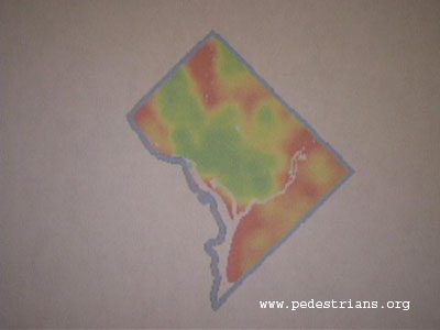
created walkability maps of the 40 largest United States cities, including
Washington, DC. The red areas represent lower Walk Scores, while the
green areas represent higher Walk Scores. The Walk Score is a rough
measurement of how many destinations are within walking distance of
a given address. It doesn't tell you if there are good sidewalks and
crosswalks, but the utility of sidewalks is limited without destinations
to walk to.
|
Topics in Episode 154:
-
We travel to Seattle to learn about Walk Score.
-
We talk with an advocate about traffic safety.
-
We look at a sidewalk initiative in Olympia.
|